
Tantalus Range
If you are looking to get a class V deep tissue massage of neural proportions, anyone who has been knows that the south coast range of British Columbia simply cannot be topped. Little did I know that the glacially carved fjords of the sea to sky corridor and the gorges that inhabit them also afford a high end couples experience as well. Laura had never been to the Northwest, and since I've been a number of times, I was able to plan a retry on our honeymoon that boated more like a paddling trip the first time around. I'll refrain from the blow by blow, and just speak in the tongue of the jpeg, as that usually performs as eloquently as any half-motivated blog post. A sure sign that the end is nigh, that the reserve tank is engaged, when the lazy bloggist, well past his peak of interest, reverts to sandbaggery; photo essays.

Yeah, she deserves better

North Creek above its confluence with the Lillooet

Looking up the massive devastation of the Mt Meager Lanslide of 2010.

Typical BC Backcountry view

The land of color

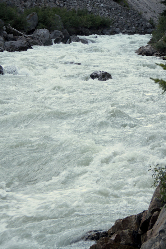
Why don't we just drop in to gorges in BC?

This could be why.

Always rent a 4wd truck in BC

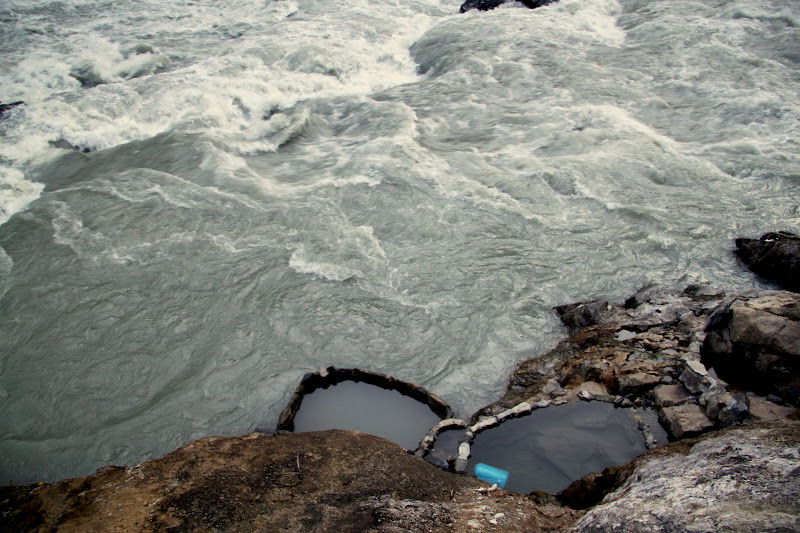
The view from the lip of Keyhole Falls into the hot springs canyon of the Lillooet

If it looks like class 4-5 from 300 feet above......

Canadians take pride in their trailbuilding

Laura traversing to our favorite spot on the trip

Perfect Hot Springs in the eddy of a big volume class V rapid
Heaven


Dusk view on our way back out to Pemberton

A new day

This does NOT suck!

Starting our morning hike to Joffre Lakes. This is the lower lake.

The trails in BC are just like everything else: rugged, big, and awe-inspiring

Middle Joffre Lake

Upper Joffre Lake


Like I said, it's all about the colors.

I don't even know what to say about the color of this water.

Middle Joffre Lake again, this time on the way out.


Day two second half of surf & turf: Birkenhead River

Laura paddling her first BC river

Twenty One Mile Creek

Ashlu Box Canyon

Some eddies you just have to catch, even if they aren't must makes.

The heart of the Box Canyon. This place represents the earthbound pinnacle of aesthetic class V kayaking.

Laura scouting a basalt ledge on the Upper Callaghan

She's my best friend, and she can boof. Grateful? Yes.

That smile is why I booked the trip.


A class 3 taste of BC canyon boating

Takeout flora

Takeout view of Black Tusk

Alexander Falls on the road to Callaghan Lake

Paddling across Callaghan Lake to the "trail" up to Cirque Lake.

1200 feet in a mile.

Yep, still frozen over in August. Cirque Lake

Looking way out all the way down the Callaghan and across the Cheakamus to Black Tusk

Relaxing and contemplating what we just climbed

A closer perspective of our route
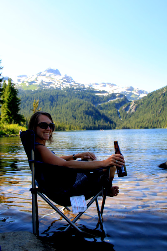
Our first vacation in 6 years

Callaghan at dawn


Laura getting in for some BC class II-III, which is more like the Middle Gauley.

My babe in action

Our dream home in the hamptons of BC, the Fraser Valley

Why paddling the Chehalis is about more than rapids

Our final day in BC where we finally got our southeastern style boat session

some bird we saw in a tree

It's probably wondering why anyone would run the Chehalis this low


This river was insanely beautiful, and had fun rapids for miles. This was about 3 weeks or more after the locals leave it alone, and it still boated like the Nolichucky at 1000. If this river was in the southeast, it would be a zoo every weekend. Them Canadians should consider themselves lucky, ehh?

Back in the states, Nooksack Falls

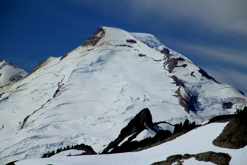
Mount Shuksan

A few feet of snow

Mount Baker, a truly badass mountain with great whitewater rivers coursing from its shoulders

Bergschrunds, crevasses and seracs, Oh My! I know not of these foreign and intimidating features. We are always limited by that which we don't know or understand.

Scenic Drive

Picture Lake

See ya next time