Wildfire of dawn, from my new back porch.
Nothing epic to see here, just some highlights from the day to day during the late winter months. One thing that I finally got around to was executing on a short shuttle for the Elk that I had been looking at for years. The Elk is a fantastic run, but the length of time required for a run through this awesome gorge has always made Linville the easier call when in the area. The normal shuttle is almost an hour each way, and the first majority of the run is flatwater, excepting the Big Falls. I have never been real interested in the big drop, so to me the whole whitewater section is only 1.5 miles at the end of the run. After a few hiking trips, I figured this out:
You can take out at the normal TO, but after starting up the hill towards the putin, and after turning onto Clawson Road, a half mile later turn right onto Dark Ridge Road. This will quickly wind past a private home before continuing up to a FS gate. It has been open the three times I have been up there this year. Details are tricky, but if you go exactly 2 miles past the gate on this FS road, there will be a little trail off to the right that drops 1/3 mile down to the river. This puts you in right above the beginning of the good whitewater. Details will be forthcoming as access becomes ironed out a little better. You can also takeout a short ways below the falls and hike a gruelling 20 minutes back up the FS gate if you are without a second car, but parking at this location has yet to be worked out. So its either a 2.3 mile hike in or a 0.3 mile hike in, depending on whether the gate is open or not. For a little comparison, a group met at the takeout an hour and a half before I got to the river, drove shuttle to the top the normal way and put on. When I got to Dark Ridge Road, the gate was open so I drove my gear to the hike in trail, drove back down, and jogged back up to my gear. I then hiked off trail (the trail isn't quite cut yet) to the put in, geared up, and waited close to an hour for the other group to catch up to me. So it saves massive amounts of time. The first time I did it, I hiked 2.3 miles in with boat, ran the whole section, portaged solo through Twisting Falls, and hiked out the brutal hike out all in two and a half hours. Here are a few shots from my second time doing this, when I met up with another group.

Caaahhh! Caaaahhh!

The best portage in the southeast?

Hey buddy, don't drop my boat.

Twisting Falls Gorge is an amazing place to feel at one with the river;

Literally! This hole is always up for a snack.

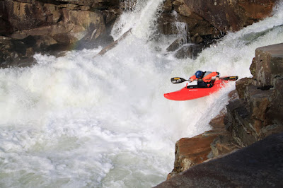
The classic and clean southern 30 footer, paddler Brian Pickett

Pete Beck following procedure on Compression Falls
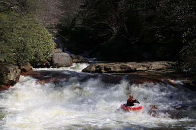
Moving on, if you look carefully, you can see a kayaker falling down the classic southeast boulder rapid:

Todd Scott paying the rent on the K-town Kwick-Sick.

Bottom drop
Last year, I planned a most excellent trip to West Virginia to run the Upper Blackwater and the Lower Meadow. Everyone had a great time. Perfect flows, temps and good lines were had by all. The problem is that I didn't get to go on my own trip. That is how it has gone for me for so long when trying to make it up to the Canaan Valley region, but this year my trusty local newspaper astrologist said good things were coming to me, and boy was she right! So while flows were too high for the Upper, we still managed to get on the North Fork at good flows two days in a row.

Fayetteville Bill showing off "the thirty footer"

Robert Bone inducing some mash.

Setting safety at Double Indemnity/Rainbow Room.

I can't say enough about the North Fork. While the water quality and epicness are lacking, from start to finish it is one quality piece of creekdom after another stacked up for an honest mile. One lap and you know it, and it is most certainly the best bomb run in West Virginia. So many slides and boofs, and Gluteal is pretty awesome. Almost the best part is when you are tired of hiking back up for more, the lower Blackwater has some romping flows for the other half of you that has yet to be awoken. Waterboofing and holepunching await on the Lower, and it is always satisfying to start your day sliding and falling and end it stroking and flowing.

Bone emerging from halfway to Indonesia.

The family truckster's inaugural dirtbag creek trip. Laura told me to take real good care of it. I did untill someone got food poisoning and ralphed all down the side of it in Mo-town. Almost brought me back to the good ole days.
I hadn't run the Big Sandy in years, but we got on it with good water and great people. When the flows are solid and the weather clear, you really can't beat a nice trip down the Big Sandy. It is classic West Virginia.

Matt Anger with a conclusive boof. Despite his name, he was quite well mannered the whole trip.

Bone emerging from the unanimously agreed upon "cherry" line of the day.
Due to intestinal issues from what will remain an unitentified Indian Restaurant in the northern part of the state, my crew of 3 quickly dwindled down to just me. Bill set me up with some good folks out of Fayetteville for a quick run down the meadow the following morning, and I spent an unusually quiet night at Summersville Dam, soothed to sleep by the Spring roar of the iconic concrete phalluses that seldom speak during fall release.
Sometimes you bring a camera with the intentions of documentation, and then end up having more on your hands than choosing camera angles and such. The next morning was one of those occasions, where while vertically squirting through Brink of Disaster at high water I reallized that my camera would only serve to provide additional weight for the carry out. An hour or so later, and I was at the takeout walking up the trail, thanks to the good info and solid pace Todd and Sam gave. The Meadow is one of the best rivers in the east, and untill I run the Upper B, it is definitely the best river I have run in West Virginia. It beats the Upper Yough and the Russell Fork, and is never crowded.
Working on a rail job in Somerset, KY, I got another opportunity to run the Rockcastle River. The narrows section has become the local afternoon fix for the past few years, partly due to lake levels dropping and uncovering the bottom drops. The other cause of increased use is the modern shift from a boater's willingness to paddle flatwater to a boater's tolerance for hiking. The Rockcastle has replaced the Cumberland River as the local run because it can be done much more quickly, and has a short hike in instead of a long paddle out. The short shuttle seals the deal on what has certainly become the popular place to meet up and get some boating in on weeknights in Kentucky.
I met up with the local crew late in the day and had a great time watching them enjoy their home river. The Rockcastle has some action on it, and some decent surfing and great scenery. Thanks again to the Kentucky crew for letting me join them on their afternoon session.

Probably some good climbing up here too.

While the surfing is good, there are some doomy undercuts
on this run too, as seen down low on river right.
On the following weekend, I took the family on an impromptu "cavenoeing" trip 5 miles from the house. Gotta get back in there to see how far it goes.

Exploring Ten Mile Cave
Why isn't the following shot accompanied by many more from the same trip? Well, a short ways below this most epic of boofs, I got throttled, had my paddle taken from me and shoes ripped off, and scampered my ass back down to the car, thankful that I was still breathing and once again reminded that the boulder gardens of the smokies are the ultimate humbler in the southeast. Maybe after my next successful run, I will be able to post about how Hike up Ramseys section of the Middle Prong is the best boulder run in the east coast, and that it is the cream of the crop of hard burly runs in the area. But after a later and unsuccessful 4 hour search four my shoes and paddle, I am childishly soured by the mention of the place. Perhaps next time I will make it more than half a mile before the river starts undressing me.

Best Boof on the frontside of the park.

We got skunked on our seasonal wildflower hike up Porters Creek,
but we did manage to find this badass stick!

1 comment:
Keith, any chance you could give me some visual indicators as to where you turn right off of the FS road? Today a buddy of mine and I hiked what we felt like was at least 2mi in past the gate and tried several right hand turns, all of which seemed to fizzle out into game trails. Any landmarks? (ie. big clearing on the right, or after crossing a significant feeder creek? Any way of describing the trail intersection could help. Thanks. If you do have something, email me at jpbevilaqua@yahoo.com
Post a Comment